“Korean Land, Dokdo” Japanese map showing national borders discovered N
No.88351- Writer YU
- Date : 2010.07.08 08:58
- Views : 12475
<日露淸韓明細新圖> published by the Japanese \'Imperial Land and Sea Measuring Department’ in 1903
[April 1, 2010]
Five sociology textbooks for 5th and 6th grade students in Japanese elementary schools that claim Dokdo as Japanese territory were approved by the Japanese Ministry of Literature and Science on March 30, thus strengthening the Japanese education on claims of Dokdo as their territory for young students. At such point, a map published by a Japanese national institution that clearly drew borders and recognized Dokdo as Korean territory was disclosed for the first time, thus showing that the current Japanese claims are not true.
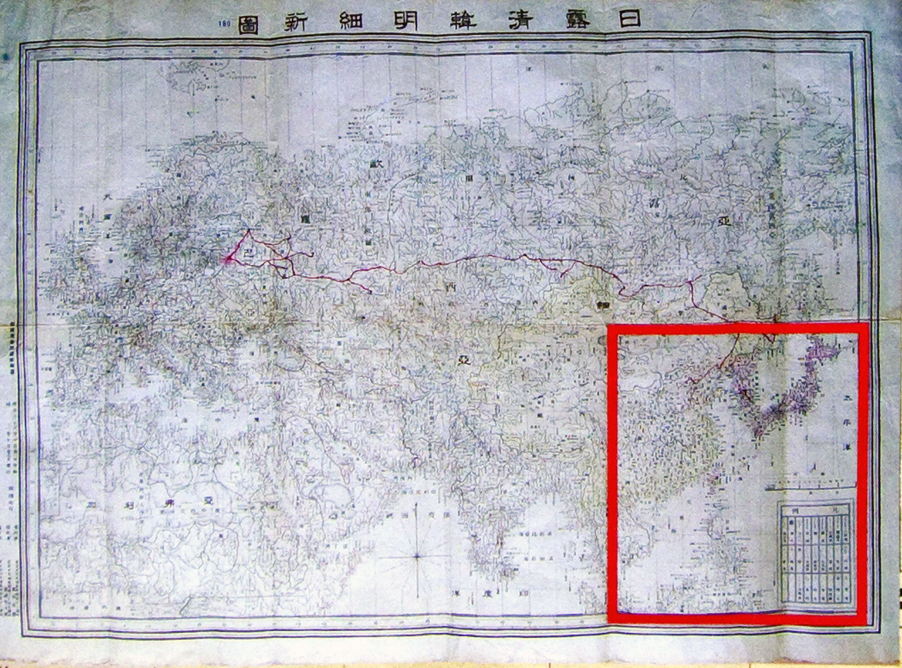
On the 1st, the Yeungnam University Dokdo Institute (director Kim, Hwa-gyeong), which is a policy-oriented research center designated by the Ministry of Education, Science and Technology (MEST), disclosed the <日露淸韓明細新圖> published by the Japanese \'Imperial Land and Sea Measuring Department’ in October 1903 (36th year of Meiji Dynasty). The map was acquired by Yoo Sung-cheol (51, Dong-gu, Daegu) who has been collecting material on Dokdo for the past 10 years, and after being recently appraised by the Yeungnam University Dokdo Institute, it was disclosed to the public.
This map, which accurately draws Asia, Europe and Africa using a precise scale, shows that Jukdo (竹島, currently Ulleung-do) and Songdo (松島, currently Dokdo) are of Joseon (Korean) territory. And territorial sea of Greater Korean Empire is described as \'Goryuhae\'.
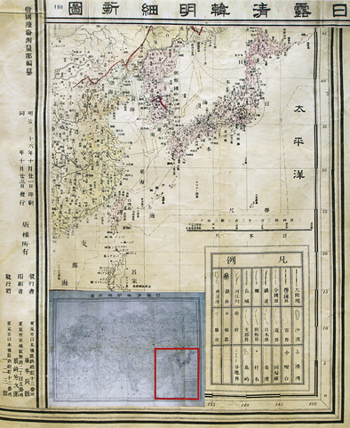
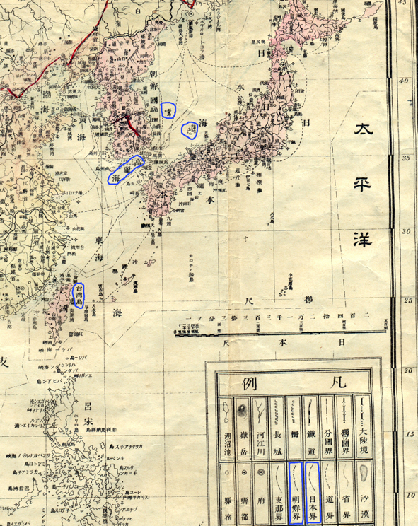
In particular, the map separates the border between Korea and Japan right in between Dokdo and Okido, and thus shows that the Japanese government recognized Dokdo to be the eastern most part of the Greater Korean Empire. Meanwhile, this map includes Taiwan as Japanese territory.
On this, Kim, Hwa-gyeong, director of the Yeungnam University Dokdo Institute explained \"It is presumed that the primary objective of making this map was to officialize Taiwan, which Japan acquired through the first Sino-Japanese War, as its territory, and there is a high possibility that the production of a map that includes Russia, China, Korea and Japan was to prepare for the Russo-Japanese War.\"
Director Kim stressed that \"Since there is clear evidence that Japan admitted and recognized Dokdo as Korean territory, Japan should immediately stop their early childhood education on claiming Dokdo as Japanese territory\" and emphatically added \"While we have been claiming \'effective control\' and making an emotional and one-time response, Japan has systematically conducted research on lobbying and education. We must establish Dokdo policies focusing on being accurately aware of reality and pursue the policies in a consistent and systematic manner.\"
Meanwhile, the Yeungnam University Dokdo Institute opened its doors as the first research institute specializing in Dokdo among Korean universities in May 2005, and in March 2008, it was designated as a policy-oriented research institute by MEST. Thus, for the next nine years, it will receive national funding to conduct academic research and policy development research to prove that \"Dokdo is Korean land\" and currently, it is aiming at establishing the \'Dokdo Research Foundation\' by initiating cooperation by the government and local autonomies.